Map Of The Carolinas From 1685 Sells For $29,325
March 15, 2024
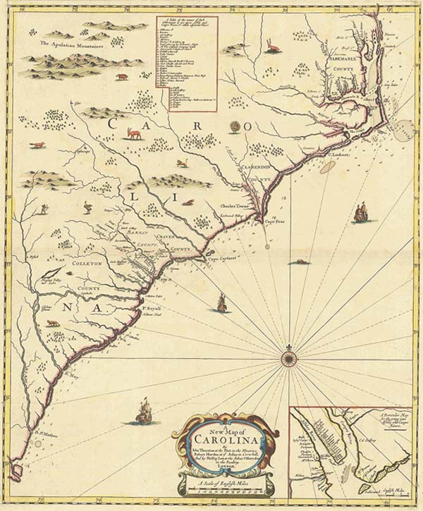
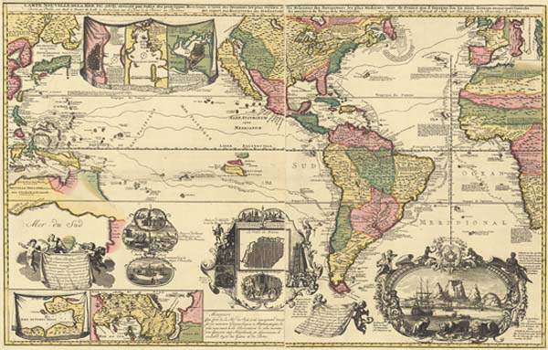
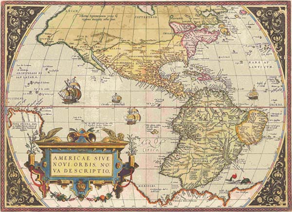
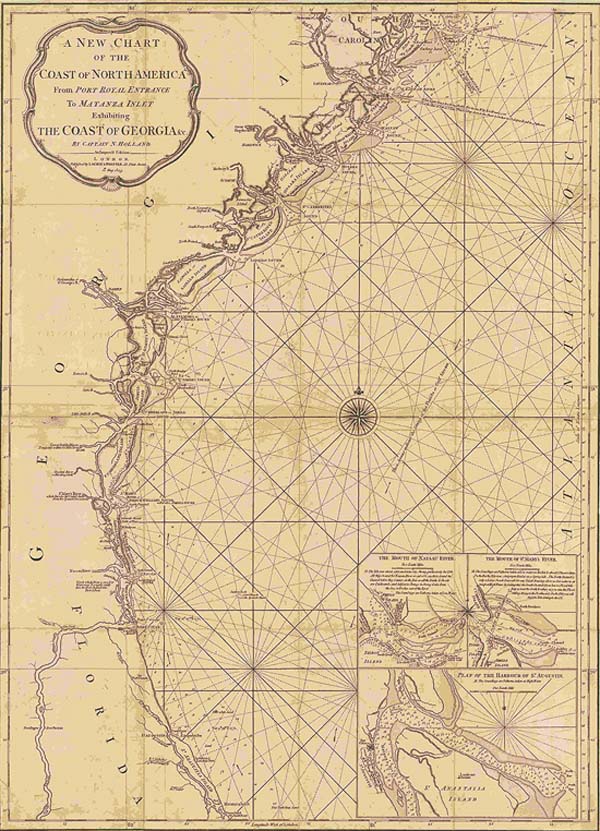
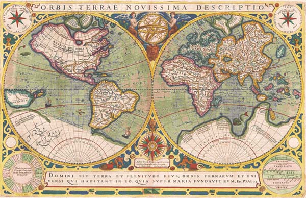
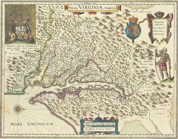
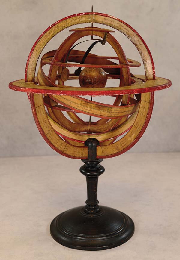
A rare early first state map of the Carolinas from 1685 sold for $29,325 and a map of the Americas and surrounding oceans from 1740 rose to $20,125 in Old World Auctions online-only Auction #196, which ended on Feb. 7. The sale totaled $420,277. Taking top lot honors was the A New Map of Carolina by Thornton, Morden & Lea. The map showed early settlements and land owners and included depictions of Native Americans and animals, such as a turkey and even an ostrich. The map market continues to be robust, said Eliane Dotson, who co-owns Old World Auctions with her husband, Jon. We saw numerous items sell for well above their estimates, and there was strong bidder participation overall. Several of the categories that did particularly well were early world maps and 19th century Americana. Of the 790 lots offered, 698 were sold. That was an 88 percent sell-through rate. All prices quoted include the buyers premium. A rare first plate map of the New World from 1573 by Abraham Ortelius, titled Americae sive Novi Orbis, Nova Descriptio, is one of the most famous maps of America and one that had enormous influence on the future cartography of the New World. It went above estimates to finish at $10,925. A New Chart of the Coast of North America from Port Royal Entrance to Matanza Inlet, by Laurie & Whittle from 1809, a rare, separately-issued chart focusing on the coastline of Georgia, extending north to Hilton Head and south to St. Augustine, sold for $10,350. A William Blaeus 1642 map titled Nova Virginiae Tabula is derived from Capt. John Smiths map of 1612 and is one of the most important 17th century maps of the Chesapeake Bay. The pre-sale estimate was $1,800-$2,100, and it sold for $9,775. A Journal of the Proceedings in Georgia by William Stephens from 1742 is a rare journal written by Stephens prior to his term as governor of the Province of Georgia. The two-volume set was published in only 70 copies, made for the Trustees of Georgia. It was expected to achieve $3,000-$4,000 but in the end changed hands for $6,900. A French armillary sphere depicted on the Ptolemaic model with the earth at its center, created in 1800 by an anonymous maker, featured a miniature terrestrial globe flanked by two small metal discs representing the sun and moon that orbited by rotating brass arms. On an ebonized stand that attracted bidders, the final price went past high estimate for $3,900. Established in 1977,OldWorldAuctionsis a leading specialist in antique maps. The company has researched and listed over 100,000 maps and atlases in itsauctionsand offers its research free to the public through its online archive.OldWorldAuctions maintains an A+ rating with the Better Business Bureau. To learn more, visit www.OldWorldAuctions.com.